Click here to view this Panorama

In 1613, Derry was granted a Royal Charter by King James I and the "London" prefix was added to the city name. Now, offically the city is known as Londonderry. Also nicknamed as the 'Maiden City' as its city walls were never breached despite being besieged on three separate occasions in the 17th century. The most notable attempt being the Siege of Derry of 1688/89. Londonderry or Derry, is the second-largest city in Northern Ireland, second to Belfast.

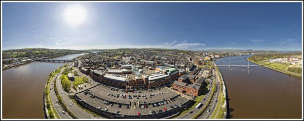
The old walled city lies on the west bank of the River Foyle, which is spanned by two road bridges and one footbridge. The city now extends to cover both banks where the local areas are known as the Cityside on the west and Waterside on the east. Opened on 25 June 2011, The Peace Bridge which spans the River Foyle, connects Ebrington Square with the rest of the city centre. Being a footbridge, it is the newest of three bridges in the city, the others being the Craigavon Bridge and the Foyle Bridge.